 vesseltracker.com
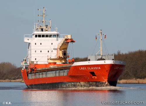
 Lady Claudia
Current Status
Where is the vessel?
Lady Claudia is currently in Near Rethimnon, based on AIS data received about 97d ago.
Latest AIS update:
Current position: 35.45596° N, 24.47684° E (Near Rethimnon)
Average speed (last 7 days): Loading…
Average speed (last 30 days): Loading…
Vessel profile: Lady Claudia is a General Cargo Ship with dimensions 109m x 16m.
This page combines live AIS, route history, probable destination signals, nearby traffic, and port activity for practical vessel monitoring.
The current position of vessel Lady Claudia is 35.45596 lat / 24.47684 lng. Updated: 2026-01-21 07:02:44 UTCNearest reference points:
- Near Kali Limenes
- Near Iraklion
- 17 nm W of Milos (Adamas)
Currently sailing under the flag of Netherlands ![]()
Lady Claudia built in 1999 year
Deadweight:
5441 tDetails:
Live Vessel Lady Claudia Analytics (details, animations, etc.)
Recent AIS points (UTC):
2026-01-21 07:02:44 UTC · 35.45596, 24.47684 · SOG 4.2 kn · COG 257°