 vesseltracker.com
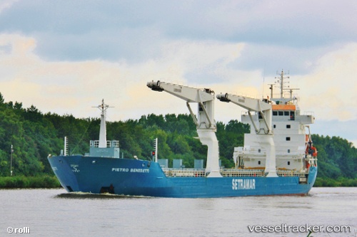
 ONEGO DUERO
Current Status
Where is the vessel?
ONEGO DUERO is currently in Near Abidjan, based on AIS data received less than 1h ago.
Latest AIS update:
Current position: 5.28930° N, 4.01653° W (Near Abidjan)
Average speed (last 7 days): Loading…
Average speed (last 30 days): Loading…
Vessel profile: ONEGO DUERO is a General Cargo Ship with dimensions 132m x 15m.
This page combines live AIS, route history, probable destination signals, nearby traffic, and port activity for practical vessel monitoring.
The current position of vessel ONEGO DUERO is 5.28930 lat / -4.01653 lng. Updated: 2026-05-16 15:44:09 UTCNearest reference points:
- Near Vridi
- Near Abidjan
- Near Espoir
Currently sailing under the flag of Netherlands ![]()
ONEGO DUERO built in 2012 year
Deadweight:
9770 tDetails:
Live Vessel ONEGO DUERO Analytics (details, animations, etc.)
Recent AIS points (UTC):
2026-05-16 12:11:15 UTC · 5.28930, -4.01654 · SOG 0 kn · COG 110°2026-05-16 13:14:19 UTC · 5.28932, -4.01655 · SOG 0 kn · COG 110°
2026-05-16 13:30:20 UTC · 5.28932, -4.01656 · SOG 0 kn · COG 109°
2026-05-16 15:44:09 UTC · 5.28930, -4.01653 · SOG 0 kn · COG 110°