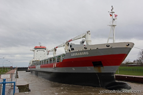
Arubaborg
Current StatusWhere is the vessel?
Arubaborg is currently in Near Ferrol, based on AIS data received about 14h ago.
Latest AIS update:
Current position: 43.47875° N, 8.24939° W (Near Ferrol)
Average speed (last 7 days): Loading…
Average speed (last 30 days): Loading…
Vessel profile: Arubaborg is a Multi Purpose Carrier with dimensions 22m x 143m.
This page combines live AIS, route history, probable destination signals, nearby traffic, and port activity for practical vessel monitoring.
The current position of vessel Arubaborg is 43.47875 lat / -8.24939 lng. Updated: 2026-05-21 04:05:53 UTCNearest reference points:
- Near Ferrol
- Near Milladoiro
- Near La Coruna
Details:
Live Vessel Arubaborg Analytics (details, animations, etc.)
Recent AIS points (UTC):
2026-05-21 01:05:54 UTC · 43.47875, -8.24939 · SOG 0 kn · COG 351°2026-05-21 01:47:55 UTC · 43.47874, -8.24938 · SOG 0 kn · COG 351°
2026-05-21 03:17:55 UTC · 43.47873, -8.24938 · SOG 0 kn · COG 351°
2026-05-21 04:05:53 UTC · 43.47875, -8.24939 · SOG 0 kn · COG 351°