 vesseltracker.com
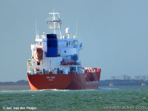
Syn Zube
Current StatusWhere is the vessel?
Syn Zube is currently in Near SARROCH, based on AIS data received about 1h ago.
Latest AIS update:
Current position: 39.11429° N, 9.04463° E (Near SARROCH)
Average speed (last 7 days): Loading…
Average speed (last 30 days): Loading…
Vessel profile: Syn Zube is a Lpg Tanker with dimensions 14m x 100m.
This page combines live AIS, route history, probable destination signals, nearby traffic, and port activity for practical vessel monitoring.
The current position of vessel Syn Zube is 39.11429 lat / 9.04463 lng. Updated: 2026-04-29 17:58:56 UTCNearest reference points:
- Near SARROCH
- Near Cagliari
- Near CARLOFORTE
Details:
Live Vessel Syn Zube Analytics (details, animations, etc.)
Recent AIS points (UTC):
2026-04-29 14:13:45 UTC · 39.11411, 9.04444 · SOG 0.3 kn · COG 117°2026-04-29 15:43:46 UTC · 39.11406, 9.04433 · SOG 0.1 kn · COG 126°
2026-04-29 16:07:46 UTC · 39.11417, 9.04463 · SOG 0.4 kn · COG 155°
2026-04-29 17:58:56 UTC · 39.11429, 9.04463 · SOG 0.2 kn · COG 138°