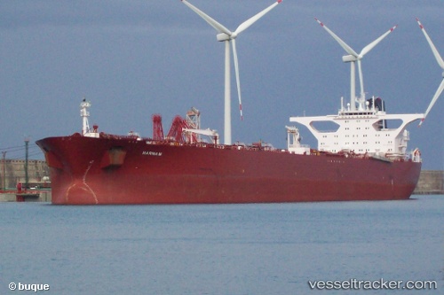
Marina M
Current StatusWhere is the vessel?
Marina M is currently in 24 nm S of Wilga, based on AIS data received about 14h ago.
Latest AIS update:
Current position: 52.03797° N, 2.37398° E (24 nm S of Wilga)
Average speed (last 7 days): Loading…
Average speed (last 30 days): Loading…
Vessel profile: Marina M is a Crude Oil Tanker with dimensions 58m x 333m.
This page combines live AIS, route history, probable destination signals, nearby traffic, and port activity for practical vessel monitoring.
The current position of vessel Marina M is 52.03797 lat / 2.37398 lng. Updated: 2026-07-18 06:06:20 UTCNearest reference points:
- 21 nm S of Craven Arms
- 11 nm NW of Krieschow
- Near Craven Arms
Details:
Live Vessel Marina M Analytics (details, animations, etc.)
Recent AIS points (UTC):
2026-07-18 02:20:49 UTC · 51.96829, 2.36706 · SOG 6.3 kn · COG 327°2026-07-18 03:39:29 UTC · 52.00735, 2.34594 · SOG 0.7 kn · COG 261°
2026-07-18 04:08:01 UTC · 52.01171, 2.35298 · SOG 1 kn · COG 272°
2026-07-18 06:06:20 UTC · 52.03797, 2.37398 · SOG 0.8 kn · COG 264°