 vesseltracker.com
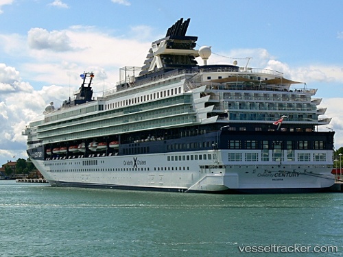
 Marella Explorer 2
Current Status
Where is the vessel?
Marella Explorer 2 is currently in Near Monaco, based on AIS data received less than 1h ago.
Latest AIS update:
Current position: 43.64443° N, 7.52885° E (Near Monaco)
Average speed (last 7 days): Loading…
Average speed (last 30 days): Loading…
Vessel profile: Marella Explorer 2 is a Cruise Ship with dimensions 247m x 32m.
This page combines live AIS, route history, probable destination signals, nearby traffic, and port activity for practical vessel monitoring.
The current position of vessel Marella Explorer 2 is 43.64443 lat / 7.52885 lng. Updated: 2026-04-24 03:51:06 UTCNearest reference points:
- Near Monaco
- Near Monte-Carlo
- Near SAINTJEAN CAP FERRAT
Currently sailing under the flag of Malta ![]()
Marella Explorer 2 built in 1995 year
Deadweight:
7260 tDetails:
Live Vessel Marella Explorer 2 Analytics (details, animations, etc.)
Recent AIS points (UTC):
2026-04-24 00:04:48 UTC · 43.59457, 8.46711 · SOG 14.7 kn · COG 273°2026-04-24 01:18:20 UTC · 43.61560, 8.05961 · SOG 12.4 kn · COG 271°
2026-04-24 01:55:56 UTC · 43.62244, 7.92288 · SOG 9.6 kn · COG 274°
2026-04-24 03:51:06 UTC · 43.64443, 7.52885 · SOG 8.6 kn · COG 275°