 MINEL VARDAL
Current Status
Where is the vessel?
MINEL VARDAL is currently in Near Hunsdon, based on AIS data received about 15h ago.
Latest AIS update:
Current position: 51.81218° N, 3.35807° E (Near Hunsdon)
Average speed (last 7 days): Loading…
Average speed (last 30 days): Loading…
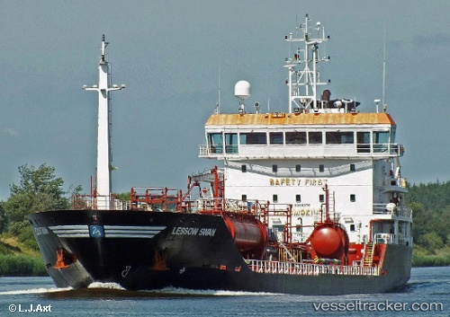
Vessel profile: MINEL VARDAL is a Oil/Chemical Tanker with dimensions m x m.
This page combines live AIS, route history, probable destination signals, nearby traffic, and port activity for practical vessel monitoring.
The current position of vessel MINEL VARDAL is 51.81218 lat / 3.35807 lng. Updated: 2026-06-24 02:21:29 UTCNearest reference points:
- Near Hunsdon
- 12 nm NE of Hunsdon
- Near OOSTWATERING
Currently sailing under the flag of Malta ![]()
Details:
Live Vessel MINEL VARDAL Analytics (details, animations, etc.)
Recent AIS points (UTC):
2026-06-23 22:38:25 UTC · 51.81398, 3.35990 · SOG 0 kn · COG 176°2026-06-23 23:35:25 UTC · 51.81392, 3.35922 · SOG 0 kn · COG 151°
2026-06-24 02:14:22 UTC · 51.81242, 3.35793 · SOG 0 kn · COG 74°
2026-06-24 02:21:29 UTC · 51.81218, 3.35807 · SOG 0 kn · COG 71°