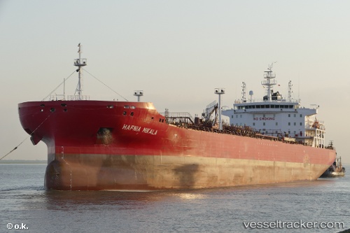
Hafnia Mikala
Current StatusWhere is the vessel?
Hafnia Mikala is currently in 99 nm NE of Kitadaito Apt, based on AIS data received about 16h ago.
Latest AIS update:
Current position: 26.80973° N, 132.86421° E (99 nm NE of Kitadaito Apt)
Average speed (last 7 days): Loading…
Average speed (last 30 days): Loading…
Vessel profile: Hafnia Mikala is a Chemical Oil Products Tanker with dimensions 32m x 183m.
This page combines live AIS, route history, probable destination signals, nearby traffic, and port activity for practical vessel monitoring.
The current position of vessel Hafnia Mikala is 26.80973 lat / 132.86421 lng. Updated: 2026-06-20 13:15:06 UTCNearest reference points:
- 107 nm NE of Kitadaito Apt
Currently sailing under the flag of
Hafnia Mikala built in 0 year
Deadweight:
0 tDetails:
Live Vessel Hafnia Mikala Analytics (details, animations, etc.)
Recent AIS points (UTC):
2026-06-20 11:31:11 UTC · 26.61612, 133.10715 · SOG 13 kn · COG 309°2026-06-20 13:15:06 UTC · 26.80973, 132.86421 · SOG 11 kn · COG -1°
2026-06-20 13:15:06 UTC · 26.80973, 132.86421 · SOG 11 kn · COG -1°
2026-06-20 13:15:06 UTC · 26.80973, 132.86421 · SOG 11 kn · COG -1°