 YANG A
Current Status
Where is the vessel?
YANG A is currently in 11 nm S of Karystos, based on AIS data received about 14h ago.
Latest AIS update:
Current position: 37.84947° N, 24.34104° E (11 nm S of Karystos)
Average speed (last 7 days): Loading…
Average speed (last 30 days): Loading…
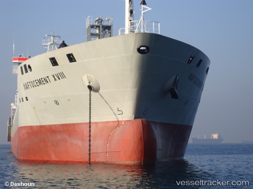
Vessel profile: YANG A is a Cement Carrier with dimensions 156m x 20m.
This page combines live AIS, route history, probable destination signals, nearby traffic, and port activity for practical vessel monitoring.
The current position of vessel YANG A is 37.84947 lat / 24.34104 lng. Updated: 2026-06-11 07:38:11 UTCNearest reference points:
- Near LAVRIO
- Near LAVRIO MARINA
- Near Kéa (Tzia)
Currently sailing under the flag of Portugal (MAR) ![]()
YANG A built in 2009 year
Deadweight:
15500 tDetails:
Live Vessel YANG A Analytics (details, animations, etc.)
Recent AIS points (UTC):
2026-06-11 04:34:02 UTC · 38.16919, 24.73758 · SOG 10.9 kn · COG 200°2026-06-11 04:44:11 UTC · 38.14113, 24.72176 · SOG 10.6 kn · COG 202°
2026-06-11 05:35:01 UTC · 38.00420, 24.64818 · SOG 10.3 kn · COG 206°
2026-06-11 07:38:11 UTC · 37.84947, 24.34104 · SOG 1.1 kn · COG 290°