 vesseltracker.com
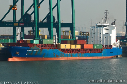
 Libertas h
Current Status
Where is the vessel?
Libertas h is currently in 20 nm E of CANET EN ROUSSILLON, based on AIS data received about 1h ago.
Latest AIS update:
Current position: 42.72318° N, 3.49584° E (20 nm E of CANET EN ROUSSILLON)
Average speed (last 7 days): Loading…
Average speed (last 30 days): Loading…
Vessel profile: Libertas h is a Multi Purpose Carrier with dimensions 128m x 20m.
This page combines live AIS, route history, probable destination signals, nearby traffic, and port activity for practical vessel monitoring.
The current position of vessel Libertas h is 42.72318 lat / 3.49584 lng. Updated: 2026-03-26 07:25:32 UTCNearest reference points:
- Near Port Vendres
- Near CANET EN ROUSSILLON
- Near Alénya
Currently sailing under the flag of Portugal ![]()
Libertas h built in 2007 year
Deadweight:
8716 tDetails:
Live Vessel Libertas h Analytics (details, animations, etc.)
Recent AIS points (UTC):
2026-03-26 01:37:01 UTC · 42.05499, 3.38985 · SOG 6.8 kn · COG 9°2026-03-26 04:00:50 UTC · 42.30020, 3.44891 · SOG 6.5 kn · COG 4°
2026-03-26 06:24:20 UTC · 42.58306, 3.47291 · SOG 8.2 kn · COG 5°
2026-03-26 07:25:32 UTC · 42.72318, 3.49584 · SOG 8.7 kn · COG 0°