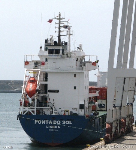
 Ponta Do Sol
Current Status
Where is the vessel?
Ponta Do Sol is currently in 13 nm SW of Eckerö, based on AIS data received about 15d ago.
Latest AIS update:
Current position: 60.05518° N, 19.33768° E (13 nm SW of Eckerö)
Average speed (last 7 days): Loading…
Average speed (last 30 days): Loading…
Vessel profile: Ponta Do Sol is a Multi Purpose Carrier with dimensions 101m x 16m.
This page combines live AIS, route history, probable destination signals, nearby traffic, and port activity for practical vessel monitoring.
The current position of vessel Ponta Do Sol is 60.05518 lat / 19.33768 lng. Updated: 2026-05-27 19:33:37 UTCNearest reference points:
- Near RAVSNAS
- Near GRADDO
- Near Kapellskär
Currently sailing under the flag of Portugal ![]()
Ponta Do Sol built in 1997 year
Deadweight:
5184 tDetails:
Live Vessel Ponta Do Sol Analytics (details, animations, etc.)
Recent AIS points (UTC):
2026-05-27 19:33:37 UTC · 60.05518, 19.33768 · SOG 8.4 kn · COG 323°