 vesseltracker.com
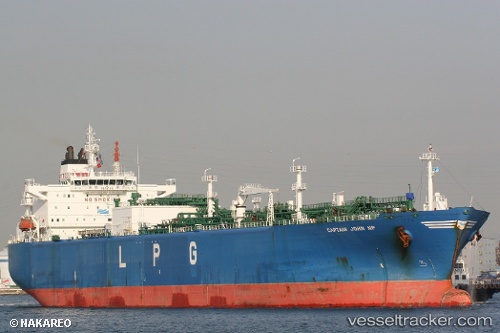
Vessel CAPTAIN JOHN NP IMO: 9347504, MMSI: 255915947 Lpg Tanker
UTC, 54.47425, 175.36063, course: 270, speed: 13.9
UTC, 54.47635, 174.37572, course: 268, speed: 14.1
2026-02-27 21:56:33 UTC, 54.35115, 173.55318, course: 251, speed: 14
Live AIS position:
UTC. 84 nm N of Attu Island),
updated 2026-02-27 21:56:33 UTC.
Find the position of the vessel CAPTAIN JOHN NP on the map. The latter are known coordinates and path.
marine traffic ship tracker show on live map
The current position of vessel CAPTAIN JOHN NP is 54.35115 lat / 173.55318 lng. Updated: 2026-02-27 21:56:33 UTCCurrently sailing under the flag of Portugal
Details:
Last coordinates of the vessel:
UTC, 54.47072, 175.96999, course: 271, speed: 13.6UTC, 54.47425, 175.36063, course: 270, speed: 13.9
UTC, 54.47635, 174.37572, course: 268, speed: 14.1
2026-02-27 21:56:33 UTC, 54.35115, 173.55318, course: 251, speed: 14