 vesseltracker.com
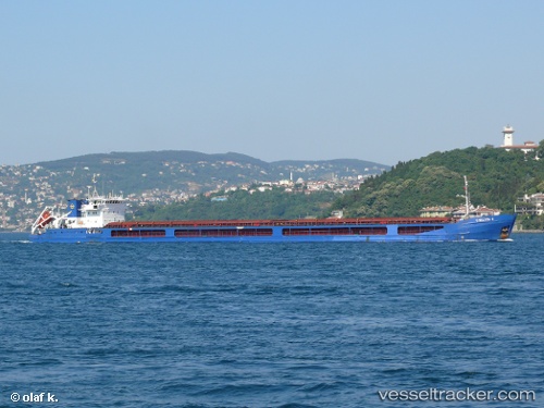
 Chelsea 2
Current Status
Where is the vessel?
Chelsea 2 is currently in 47 nm S of Sulina (Port et Zone Franche), based on AIS data received about 1h ago.
Latest AIS update:
Current position: 44.37891° N, 29.88314° E (47 nm S of Sulina (Port et Zone Franche))
Average speed (last 7 days): Loading…
Average speed (last 30 days): Loading…
Vessel profile: Chelsea 2 is a Multi Purpose Carrier with dimensions 138m x 16m.
This page combines live AIS, route history, probable destination signals, nearby traffic, and port activity for practical vessel monitoring.
The current position of vessel Chelsea 2 is 44.37891 lat / 29.88314 lng. Updated: 2026-04-16 11:23:26 UTCNearest reference points:
- 12 nm SE of Sulina (Port et Zone Franche)
- 13 nm E of Sulina (Port et Zone Franche)
- 20 nm E of Eforie Sud
Currently sailing under the flag of Malta ![]()
Chelsea 2 built in 2005 year
Deadweight:
6081 tDetails:
Live Vessel Chelsea 2 Analytics (details, animations, etc.)
Recent AIS points (UTC):
2026-04-16 05:32:26 UTC · 44.03849, 29.49048 · SOG 5.3 kn · COG 33°2026-04-16 05:32:26 UTC · 44.03849, 29.49048 · SOG 5.3 kn · COG 33°
2026-04-16 09:53:22 UTC · 44.26322, 29.86731 · SOG 5 kn · COG 71°
2026-04-16 11:23:26 UTC · 44.37891, 29.88314 · SOG 5.8 kn · COG 350°