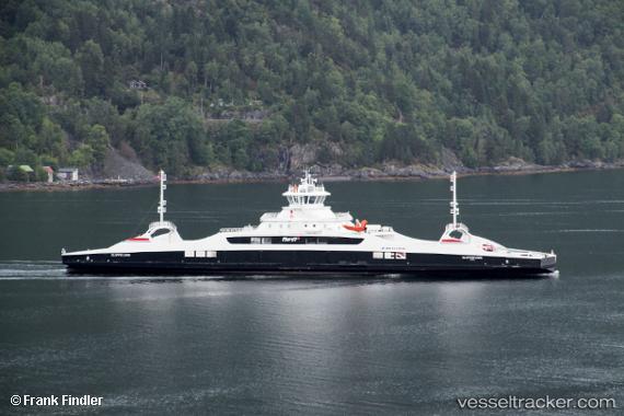
 Gloppefjord
Current Status
Where is the vessel?
Gloppefjord is currently in Near NORDFJORDEID, based on AIS data received about 14h ago.
Latest AIS update:
Current position: 61.86378° N, 6.08059° E (Near NORDFJORDEID)
Average speed (last 7 days): Loading…
Average speed (last 30 days): Loading…
Vessel profile: Gloppefjord is a Passenger Ro Ro Cargo Ship with dimensions 106m x 17m.
This page combines live AIS, route history, probable destination signals, nearby traffic, and port activity for practical vessel monitoring.
The current position of vessel Gloppefjord is 61.86378 lat / 6.08059 lng. Updated: 2026-05-22 21:42:35 UTCNearest reference points:
- Near Alesund
- Near Larsnes
- Near Fiskarstrand
Currently sailing under the flag of Norway ![]()
Details:
Live Vessel Gloppefjord Analytics (details, animations, etc.)
Recent AIS points (UTC):
2026-05-22 17:31:15 UTC · 61.84711, 6.08130 · SOG 1.5 kn · COG 153°2026-05-22 19:23:30 UTC · 61.86313, 6.08204 · SOG 4.5 kn · COG 312°
2026-05-22 20:01:29 UTC · 61.86317, 6.08153 · SOG 4.2 kn · COG 149°
2026-05-22 21:42:35 UTC · 61.86378, 6.08059 · SOG 0 kn · COG 115°