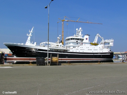
 Christina E
Current Status
Where is the vessel?
Christina E is currently in Near Mjølstadneset, based on AIS data received about 14h ago.
Latest AIS update:
Current position: 62.32427° N, 5.66310° E (Near Mjølstadneset)
Average speed (last 7 days): Loading…
Average speed (last 30 days): Loading…
Vessel profile: Christina E is a Fish Carrier with dimensions 81m x 81m.
This page combines live AIS, route history, probable destination signals, nearby traffic, and port activity for practical vessel monitoring.
The current position of vessel Christina E is 62.32427 lat / 5.66310 lng. Updated: 2026-06-19 10:26:21 UTCNearest reference points:
- Near Larsnes
- Near Gursken
- Near Alesund
Currently sailing under the flag of Norway ![]()
Christina E built in 2011 year
Deadweight:
3500 tDetails:
Live Vessel Christina E Analytics (details, animations, etc.)
Recent AIS points (UTC):
2026-06-19 07:56:20 UTC · 62.32428, 5.66311 · SOG 0 kn · COG 242°2026-06-19 08:26:26 UTC · 62.32427, 5.66316 · SOG 0 kn · COG 242°
2026-06-19 10:23:22 UTC · 62.32426, 5.66310 · SOG 0 kn · COG 242°
2026-06-19 10:26:21 UTC · 62.32427, 5.66310 · SOG 0 kn · COG 242°