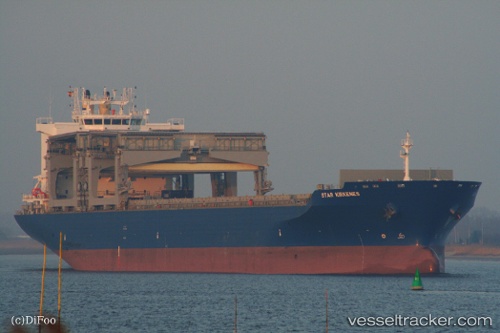
 Star Kirkenes
Current Status
Where is the vessel?
Star Kirkenes is currently in Near Kaohsiung, based on AIS data received about 15h ago.
Latest AIS update:
Current position: 22.57124° N, 120.30421° E (Near Kaohsiung)
Average speed (last 7 days): Loading…
Average speed (last 30 days): Loading…
Vessel profile: Star Kirkenes is a Multi Purpose Carrier with dimensions 208m x 32m.
This page combines live AIS, route history, probable destination signals, nearby traffic, and port activity for practical vessel monitoring.
The current position of vessel Star Kirkenes is 22.57124 lat / 120.30421 lng. Updated: 2026-07-31 04:02:39 UTCNearest reference points:
- Near Kaohsiung
- Near Kao-Hsiung Kang
- Near Tso-Ying
Currently sailing under the flag of Norway ![]()
Star Kirkenes built in 2009 year
Deadweight:
49924 tDetails:
Live Vessel Star Kirkenes Analytics (details, animations, etc.)
Recent AIS points (UTC):
2026-07-31 01:28:45 UTC · 22.57127, 120.30420 · SOG 0 kn · COG 321°2026-07-31 01:40:45 UTC · 22.57124, 120.30422 · SOG 0 kn · COG 321°
2026-07-31 03:19:55 UTC · 22.57124, 120.30422 · SOG 0 kn · COG 321°
2026-07-31 04:02:39 UTC · 22.57124, 120.30421 · SOG 0 kn · COG -1°