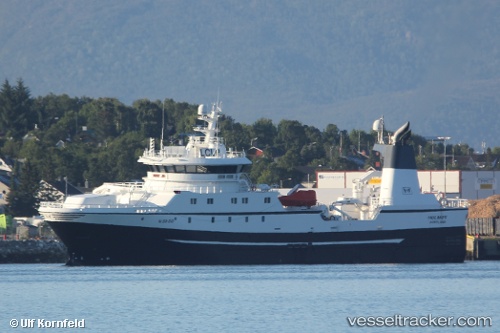
Holmoy
Current StatusWhere is the vessel?
Holmoy is currently in Near Sortland, based on AIS data received about 14h ago.
Latest AIS update:
Current position: 68.73333° N, 15.51500° E (Near Sortland)
Average speed (last 7 days): Loading…
Average speed (last 30 days): Loading…
Vessel profile: Holmoy is a Fishing Vessel with dimensions 16m x 70m.
This page combines live AIS, route history, probable destination signals, nearby traffic, and port activity for practical vessel monitoring.
The current position of vessel Holmoy is 68.73333 lat / 15.51500 lng. Updated: 2026-06-04 20:22:31 UTCNearest reference points:
- Near Sigerfjord
- Near Berrvik (Bergvik)
- Near Eidet
Details:
Live Vessel Holmoy Analytics (details, animations, etc.)
Recent AIS points (UTC):
2026-06-04 16:16:32 UTC · 68.73338, 15.51610 · SOG 0 kn · COG 332°2026-06-04 17:30:22 UTC · 68.73338, 15.51617 · SOG 0 kn · COG 332°
2026-06-04 19:02:51 UTC · 68.73340, 15.51617 · SOG 0 kn · COG 333°
2026-06-04 20:22:31 UTC · 68.73333, 15.51500 · SOG 0 kn · COG -1°