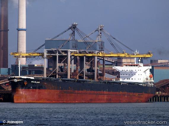
 BELISLAND
Current Status
Where is the vessel?
BELISLAND is currently in Near Saint-Céols, based on AIS data received about 14h ago.
Latest AIS update:
Current position: 47.11298° N, 2.47449° W (Near Saint-Céols)
Average speed (last 7 days): Loading…
Average speed (last 30 days): Loading…
Vessel profile: BELISLAND is a Bulk Carrier with dimensions 200m x 32m.
This page combines live AIS, route history, probable destination signals, nearby traffic, and port activity for practical vessel monitoring.
The current position of vessel BELISLAND is 47.11298 lat / -2.47449 lng. Updated: 2026-07-19 08:24:42 UTCNearest reference points:
- 12 nm S of Saint-Céols
- 13 nm S of Saint-Céols
- Near LE CROISIC
Currently sailing under the flag of Norway (NIS) ![]()
BELISLAND built in 2016 year
Deadweight:
61252 tDetails:
Live Vessel BELISLAND Analytics (details, animations, etc.)
Recent AIS points (UTC):
2026-07-19 04:06:47 UTC · 47.11541, -2.46921 · SOG 0 kn · COG 205°2026-07-19 05:24:40 UTC · 47.11573, -2.47064 · SOG 0.2 kn · COG 169°
2026-07-19 07:00:42 UTC · 47.11334, -2.47473 · SOG 0 kn · COG 60°
2026-07-19 08:24:42 UTC · 47.11298, -2.47449 · SOG 0 kn · COG 46°