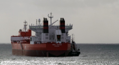
 TORILL KNUTSEN
Current Status
Where is the vessel?
TORILL KNUTSEN is currently in Near SKAGEN, based on AIS data received about 15h ago.
Latest AIS update:
Current position: 57.68453° N, 10.66323° E (Near SKAGEN)
Average speed (last 7 days): Loading…
Average speed (last 30 days): Loading…
Vessel profile: TORILL KNUTSEN is a Crude Oil Tanker with dimensions 275m x 46m.
This page combines live AIS, route history, probable destination signals, nearby traffic, and port activity for practical vessel monitoring.
The current position of vessel TORILL KNUTSEN is 57.68453 lat / 10.66323 lng. Updated: 2026-05-25 23:29:00 UTCNearest reference points:
- Near SKAGEN
- Near Frederikshavn
- 19 nm E of Sæby
Currently sailing under the flag of Norway (NIS) ![]()
TORILL KNUTSEN built in 2013 year
Deadweight:
123166 tDetails:
Live Vessel TORILL KNUTSEN Analytics (details, animations, etc.)
Recent AIS points (UTC):
2026-05-25 20:05:50 UTC · 57.68489, 10.66305 · SOG 0 kn · COG -1°2026-05-25 22:18:03 UTC · 57.68469, 10.66317 · SOG 0 kn · COG -1°
2026-05-25 22:22:45 UTC · 57.68465, 10.66316 · SOG 0 kn · COG 248°
2026-05-25 23:29:00 UTC · 57.68453, 10.66323 · SOG 0 kn · COG 251°