 vesseltracker.com
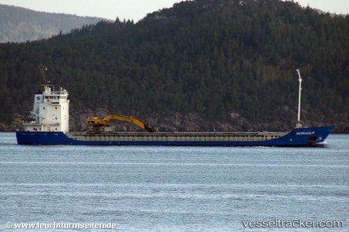
 Norholm
Current Status
Where is the vessel?
Norholm is currently in 17 nm N of Hirtshals, based on AIS data received less than 1h ago.
Latest AIS update:
Current position: 57.87795° N, 9.99908° E (17 nm N of Hirtshals)
Average speed (last 7 days): Loading…
Average speed (last 30 days): Loading…
Vessel profile: Norholm is a Multi Purpose Carrier with dimensions 94m x 15m.
This page combines live AIS, route history, probable destination signals, nearby traffic, and port activity for practical vessel monitoring.
The current position of vessel Norholm is 57.87795 lat / 9.99908 lng. Updated: 2026-05-01 04:10:26 UTCNearest reference points:
- 15 nm N of Hirtshals
- Near Hirtshals
- Near SKAGEN
Currently sailing under the flag of Norway ![]()
Norholm built in 1995 year
Deadweight:
4708 tDetails:
Live Vessel Norholm Analytics (details, animations, etc.)
Recent AIS points (UTC):
2026-05-01 01:10:45 UTC · 57.76581, 10.80243 · SOG 10.6 kn · COG 340°2026-05-01 02:33:16 UTC · 57.85565, 10.48616 · SOG 9.2 kn · COG 272°
2026-05-01 03:42:35 UTC · 57.86621, 10.13916 · SOG 9.9 kn · COG 279°
2026-05-01 04:10:26 UTC · 57.87795, 9.99908 · SOG 9.8 kn · COG 277°