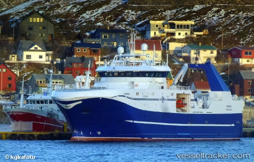
Remoy
Current StatusWhere is the vessel?
Remoy is currently in Near Tromso, based on AIS data received about 14h ago.
Latest AIS update:
Current position: 69.62674° N, 18.94503° E (Near Tromso)
Average speed (last 7 days): Loading…
Average speed (last 30 days): Loading…
Vessel profile: Remoy is a Fishing Vessel with dimensions 16m x 74m.
This page combines live AIS, route history, probable destination signals, nearby traffic, and port activity for practical vessel monitoring.
The current position of vessel Remoy is 69.62674 lat / 18.94503 lng. Updated: 2026-06-03 10:53:20 UTCNearest reference points:
- Near Tromso
- Near Tromsø
- Near SOMMAROY
Details:
Live Vessel Remoy Analytics (details, animations, etc.)
Recent AIS points (UTC):
2026-06-03 07:22:59 UTC · 69.62678, 18.94493 · SOG 0 kn · COG 32°2026-06-03 08:04:47 UTC · 69.62677, 18.94496 · SOG 0 kn · COG 33°
2026-06-03 10:10:36 UTC · 69.62679, 18.94482 · SOG 0.1 kn · COG 33°
2026-06-03 10:53:20 UTC · 69.62674, 18.94503 · SOG 0 kn · COG 32°