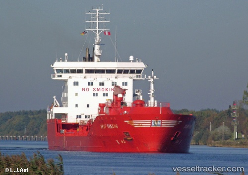
 Stav Viking
Current Status
Where is the vessel?
Stav Viking is currently in 16 nm S of Craven Arms, based on AIS data received about 14h ago.
Latest AIS update:
Current position: 52.17248° N, 2.93758° E (16 nm S of Craven Arms)
Average speed (last 7 days): Loading…
Average speed (last 30 days): Loading…
Vessel profile: Stav Viking is a Chemical Oil Products Tanker with dimensions 144m x 23m.
This page combines live AIS, route history, probable destination signals, nearby traffic, and port activity for practical vessel monitoring.
The current position of vessel Stav Viking is 52.17248 lat / 2.93758 lng. Updated: 2026-05-21 01:46:00 UTCNearest reference points:
- 21 nm S of Craven Arms
- Near Craven Arms
- Near Hunsdon
Currently sailing under the flag of Norway ![]()
Stav Viking built in 2009 year
Deadweight:
16628 tDetails:
Live Vessel Stav Viking Analytics (details, animations, etc.)
Recent AIS points (UTC):
2026-05-20 23:06:30 UTC · 51.83288, 3.15259 · SOG 7.9 kn · COG 336°2026-05-20 23:26:30 UTC · 51.87905, 3.12373 · SOG 9.3 kn · COG 341°
2026-05-21 01:26:10 UTC · 52.13173, 2.96690 · SOG 7.3 kn · COG 339°
2026-05-21 01:46:00 UTC · 52.17248, 2.93758 · SOG 7.8 kn · COG 336°