 vesseltracker.com
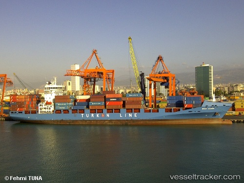
 Nevzat Kalkavan
Current Status
Where is the vessel?
Nevzat Kalkavan is currently in 15 nm W of Baba Point, based on AIS data received less than 1h ago.
Latest AIS update:
Current position: 39.48192° N, 25.73926° E (15 nm W of Baba Point)
Average speed (last 7 days): Loading…
Average speed (last 30 days): Loading…
Vessel profile: Nevzat Kalkavan is a Container Ship with dimensions 183m x 28m.
This page combines live AIS, route history, probable destination signals, nearby traffic, and port activity for practical vessel monitoring.
The current position of vessel Nevzat Kalkavan is 39.48192 lat / 25.73926 lng. Updated: 2026-04-23 13:17:14 UTCNearest reference points:
- 14 nm NW of Baba Point
- 16 nm NW of Sigri Lesvou
- 14 nm SW of Bozcaada
Currently sailing under the flag of Turkey ![]()
Nevzat Kalkavan built in 2011 year
Deadweight:
26811 tDetails:
Live Vessel Nevzat Kalkavan Analytics (details, animations, etc.)
Recent AIS points (UTC):
2026-04-23 09:47:32 UTC · 38.60973, 25.75243 · SOG 15.1 kn · COG 3°2026-04-23 10:37:07 UTC · 38.81921, 25.74592 · SOG 15.2 kn · COG 357°
2026-04-23 11:28:18 UTC · 39.03179, 25.73969 · SOG 14.9 kn · COG 1°
2026-04-23 13:17:14 UTC · 39.48192, 25.73926 · SOG 14.9 kn · COG 0°