 vesseltracker.com
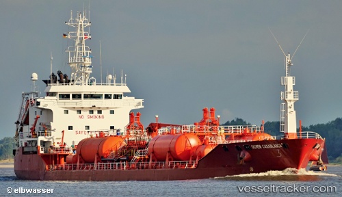
 Duruca
Current Status
Where is the vessel?
Duruca is currently in Near BAKIRKOY, based on AIS data received about 59d ago.
Latest AIS update:
Current position: 40.96024° N, 28.87980° E (Near BAKIRKOY)
Average speed (last 7 days): Loading…
Average speed (last 30 days): Loading…
Vessel profile: Duruca is a Chemical Oil Products Tanker with dimensions 117m x 18m.
This page combines live AIS, route history, probable destination signals, nearby traffic, and port activity for practical vessel monitoring.
The current position of vessel Duruca is 40.96024 lat / 28.87980 lng. Updated: 2026-02-12 19:11:53 UTCNearest reference points:
- Near BAKIRKOY
- Near ZEYTINBURNU
- Near Davutpasa
Currently sailing under the flag of Turkey ![]()
Duruca built in 1993 year
Deadweight:
6999 tDetails:
Live Vessel Duruca Analytics (details, animations, etc.)
Recent AIS points (UTC):
2026-02-12 19:11:53 UTC · 40.96024, 28.87980 · SOG 0 kn · COG 137°