 vesseltracker.com
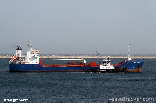
 Bayrakli
Current Status
Where is the vessel?
Bayrakli is currently in Near TUZLA, based on AIS data received less than 1h ago.
Latest AIS update:
Current position: 40.78194° N, 29.18746° E (Near TUZLA)
Average speed (last 7 days): Loading…
Average speed (last 30 days): Loading…
Vessel profile: Bayrakli is a Oil Products Tanker with dimensions 83m x 13m.
This page combines live AIS, route history, probable destination signals, nearby traffic, and port activity for practical vessel monitoring.
The current position of vessel Bayrakli is 40.78194 lat / 29.18746 lng. Updated: 2026-05-16 02:01:04 UTCNearest reference points:
- Near TUZLA
- Near PENDIK
- Near Tuzla Free Zone
Currently sailing under the flag of Turkey ![]()
Details:
Live Vessel Bayrakli Analytics (details, animations, etc.)
Recent AIS points (UTC):
2026-05-15 22:04:20 UTC · 40.76709, 29.54399 · SOG 0 kn · COG 351°2026-05-16 00:02:24 UTC · 40.75679, 29.51112 · SOG 9.6 kn · COG 260°
2026-05-16 01:32:24 UTC · 40.76745, 29.25391 · SOG 6.4 kn · COG 285°
2026-05-16 02:01:04 UTC · 40.78194, 29.18746 · SOG 6.6 kn · COG 283°