 Dnipro Line
Current Status
Where is the vessel?
Dnipro Line is currently in Near TUZLA, based on AIS data received about 14h ago.
Latest AIS update:
Current position: 40.83956° N, 29.27045° E (Near TUZLA)
Average speed (last 7 days): Loading…
Average speed (last 30 days): Loading…
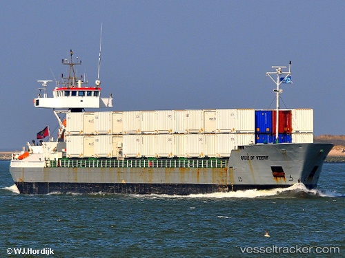
Vessel profile: Dnipro Line is a Container Ship with dimensions 110m x 12m.
This page combines live AIS, route history, probable destination signals, nearby traffic, and port activity for practical vessel monitoring.
The current position of vessel Dnipro Line is 40.83956 lat / 29.27045 lng. Updated: 2026-05-20 10:15:45 UTCNearest reference points:
- Near TUZLA
- Near PENDIK
- Near Tuzla Free Zone
Currently sailing under the flag of Ukraine ![]()
Dnipro Line built in 1998 year
Deadweight:
3200 tDetails:
Live Vessel Dnipro Line Analytics (details, animations, etc.)
Recent AIS points (UTC):
2026-05-20 07:36:45 UTC · 40.83942, 29.27048 · SOG 0.1 kn · COG -1°2026-05-20 08:12:45 UTC · 40.83937, 29.27042 · SOG 0.1 kn · COG -1°
2026-05-20 10:12:45 UTC · 40.83947, 29.27043 · SOG 0 kn · COG -1°
2026-05-20 10:15:45 UTC · 40.83956, 29.27045 · SOG 0 kn · COG -1°