 vesseltracker.com
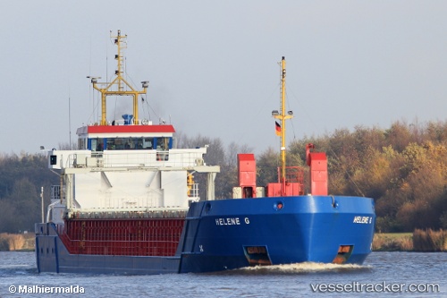
 Helene G
Current Status
Where is the vessel?
Helene G is currently in Near Casablanca, based on AIS data received less than 1h ago.
Latest AIS update:
Current position: 33.65907° N, 7.62768° W (Near Casablanca)
Average speed (last 7 days): Loading…
Average speed (last 30 days): Loading…
Vessel profile: Helene G is a Multi Purpose Carrier with dimensions 82m x 12m.
This page combines live AIS, route history, probable destination signals, nearby traffic, and port activity for practical vessel monitoring.
The current position of vessel Helene G is 33.65907 lat / -7.62768 lng. Updated: 2026-05-15 13:03:39 UTCNearest reference points:
- Near Mohammedia
- Near Jorf Lasfar
- 54 nm N of El Jadida
Currently sailing under the flag of Antigua Barbuda ![]()
Helene G built in 2001 year
Deadweight:
3156 tDetails:
Live Vessel Helene G Analytics (details, animations, etc.)
Recent AIS points (UTC):
2026-05-15 09:27:38 UTC · 33.65900, -7.62762 · SOG 0.1 kn · COG 339°2026-05-15 10:03:39 UTC · 33.65903, -7.62780 · SOG 0 kn · COG 359°
2026-05-15 11:48:38 UTC · 33.65895, -7.62765 · SOG 0.1 kn · COG 353°
2026-05-15 13:03:39 UTC · 33.65907, -7.62768 · SOG 0.1 kn · COG 350°