 SAPHIRA
Current Status
Where is the vessel?
SAPHIRA is currently in Near Mutrah, based on AIS data received about 17h ago.
Latest AIS update:
Current position: 23.66172° N, 58.57455° E (Near Mutrah)
Average speed (last 7 days): Loading…
Average speed (last 30 days): Loading…
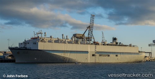
Vessel profile: SAPHIRA is a Livestock Carrier with dimensions m x m.
This page combines live AIS, route history, probable destination signals, nearby traffic, and port activity for practical vessel monitoring.
The current position of vessel SAPHIRA is 23.66172 lat / 58.57455 lng. Updated: 2026-05-19 18:49:49 UTCNearest reference points:
- 58 nm S of JASK
- 23 nm NE of Qalhat
- 42 nm SE of Offshore Fujairah
Currently sailing under the flag of Antigua and Barbuda ![]()
Details:
Live Vessel SAPHIRA Analytics (details, animations, etc.)
Recent AIS points (UTC):
2026-05-19 15:42:38 UTC · 23.66172, 58.57467 · SOG 0 kn · COG 79°2026-05-19 17:48:44 UTC · 23.66171, 58.57460 · SOG 1.9 kn · COG -1°
2026-05-19 18:49:49 UTC · 23.66172, 58.57455 · SOG 0.1 kn · COG 99°
2026-05-19 18:49:49 UTC · 23.66172, 58.57455 · SOG 0.1 kn · COG 99°