 vesseltracker.com
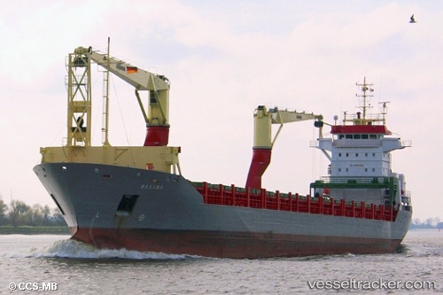
Hc Eva Marie
Current StatusWhere is the vessel?
Hc Eva Marie is currently in 46 nm SW of Fernando De Noronha, based on AIS data received less than 1h ago.
Latest AIS update:
Current position: 4.37667° S, 32.95500° W (46 nm SW of Fernando De Noronha)
Average speed (last 7 days): Loading…
Average speed (last 30 days): Loading…
Vessel profile: Hc Eva Marie is a Multi Purpose Carrier with dimensions 18m x 146m.
This page combines live AIS, route history, probable destination signals, nearby traffic, and port activity for practical vessel monitoring.
The current position of vessel Hc Eva Marie is -4.37667 lat / -32.95500 lng. Updated: 2026-04-24 23:50:26 UTCNearest reference points:
- 20 nm E of Natal
Details:
Live Vessel Hc Eva Marie Analytics (details, animations, etc.)
Recent AIS points (UTC):
2026-04-24 19:54:49 UTC · -3.67328, -33.37195 · SOG 13.1 kn · COG 140°2026-04-24 21:58:50 UTC · -4.02333, -33.10333 · SOG 12 kn · COG -1°
2026-04-24 22:41:49 UTC · -4.14630, -33.01011 · SOG 13.2 kn · COG 155°
2026-04-24 23:50:26 UTC · -4.37667, -32.95500 · SOG 12 kn · COG -1°