 vesseltracker.com
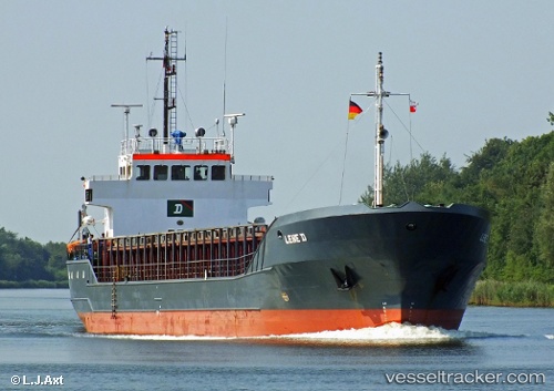
 Lene D
Current Status
Where is the vessel?
Lene D is currently in Near Obereiderhafen, based on AIS data received about 1h ago.
Latest AIS update:
Current position: 54.29283° N, 9.67376° E (Near Obereiderhafen)
Average speed (last 7 days): Loading…
Average speed (last 30 days): Loading…
Vessel profile: Lene D is a Multi Purpose Carrier with dimensions 82m x 12m.
This page combines live AIS, route history, probable destination signals, nearby traffic, and port activity for practical vessel monitoring.
The current position of vessel Lene D is 54.29283 lat / 9.67376 lng. Updated: 2026-05-14 01:28:53 UTCNearest reference points:
- Near BORGSTEDT
- Near Borgwedel
- Near Fahrdorf
Currently sailing under the flag of Antigua Barbuda ![]()
Lene D built in 1987 year
Deadweight:
1900 tDetails:
Live Vessel Lene D Analytics (details, animations, etc.)
Recent AIS points (UTC):
2026-05-13 22:58:51 UTC · 54.29281, 9.67371 · SOG 0 kn · COG 73°2026-05-13 23:52:51 UTC · 54.29284, 9.67377 · SOG 0 kn · COG 73°
2026-05-14 01:22:53 UTC · 54.29286, 9.67377 · SOG 0 kn · COG 73°
2026-05-14 01:28:53 UTC · 54.29283, 9.67376 · SOG 0 kn · COG 73°