 vesseltracker.com
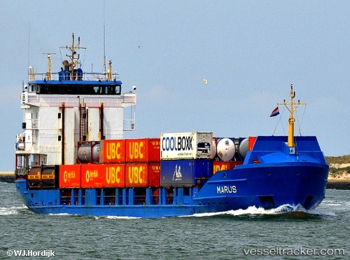
 Marus
Marus
Current Status
Where is the vessel?
Marus is currently in Near Puerto Plata, based on AIS data received about 1h ago.
Latest AIS update:
Current position: 19.80003° N, 70.70149° W (Near Puerto Plata)
Average speed (last 7 days): Loading…
Average speed (last 30 days): Loading…
Vessel profile: Marus is a Container Ship with dimensions 99m x 16m.
This page combines live AIS, route history, probable destination signals, nearby traffic, and port activity for practical vessel monitoring.
The current position of vessel Marus is 19.80003 lat / -70.70149 lng. Updated: 2026-05-15 17:39:41 UTCNearest reference points:
- Near Puerto Plata
- Near Bahia De Las Calderas
- 38 nm SW of Cockburn Harbour
Currently sailing under the flag of Antigua Barbuda ![]()
Marus built in 1996 year
Deadweight:
3950 tDetails:
Live Vessel Marus Analytics (details, animations, etc.)
Recent AIS points (UTC):
2026-05-15 13:48:42 UTC · 19.79999, -70.70148 · SOG 0 kn · COG 16°2026-05-15 16:03:41 UTC · 19.80001, -70.70152 · SOG 0 kn · COG 16°
2026-05-15 16:18:36 UTC · 19.79999, -70.70152 · SOG 0 kn · COG 16°
2026-05-15 17:39:41 UTC · 19.80003, -70.70149 · SOG 0 kn · COG 16°