 K PACIFIC
Current Status
Where is the vessel?
K PACIFIC is currently in 37 nm NE of Jingjiang, based on AIS data received about 15h ago.
Latest AIS update:
Current position: 31.48943° N, 122.93378° E (37 nm NE of Jingjiang)
Average speed (last 7 days): Loading…
Average speed (last 30 days): Loading…
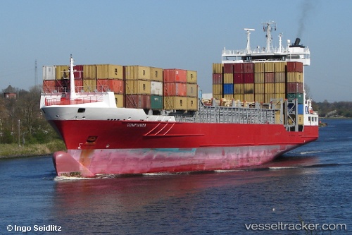
Vessel profile: K PACIFIC is a Container Ship with dimensions m x m.
This page combines live AIS, route history, probable destination signals, nearby traffic, and port activity for practical vessel monitoring.
The current position of vessel K PACIFIC is 31.48943 lat / 122.93378 lng. Updated: 2026-06-03 10:14:33 UTCNearest reference points:
- 17 nm NE of Jingjiang
- 21 nm NE of Lü-hua Shan
- 15 nm NE of Jingjiang
Currently sailing under the flag of Antigua and Barbuda ![]()
Details:
Live Vessel K PACIFIC Analytics (details, animations, etc.)
Recent AIS points (UTC):
2026-06-03 07:31:39 UTC · 31.09589, 122.79640 · SOG 14.6 kn · COG 89°2026-06-03 08:17:06 UTC · 31.09740, 123.01245 · SOG 14 kn · COG 45°
2026-06-03 09:26:43 UTC · 31.34979, 123.02111 · SOG 12.6 kn · COG 357°
2026-06-03 10:14:33 UTC · 31.48943, 122.93378 · SOG 11.9 kn · COG 334°