 VAST PLUS
Current Status
Where is the vessel?
VAST PLUS is currently in 390 nm SW of Veraval, based on AIS data received about 20d ago.
Latest AIS update:
Current position: 16.64616° N, 65.16642° E (390 nm SW of Veraval)
Average speed (last 7 days): Loading…
Average speed (last 30 days): Loading…
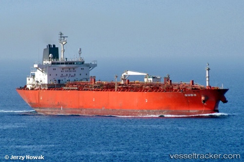
Vessel profile: VAST PLUS is a Chemical Tanker with dimensions m x m.
This page combines live AIS, route history, probable destination signals, nearby traffic, and port activity for practical vessel monitoring.
The current position of vessel VAST PLUS is 16.64616 lat / 65.16642 lng. Updated: 2026-04-30 01:09:31 UTCNearest reference points:
- Open sea, approx. 400 nm off the nearest listed port
- Open sea, approx. 404 nm off the nearest listed port
- Open sea, approx. 401 nm off the nearest listed port
Currently sailing under the flag of Aruba ![]()
Details:
Live Vessel VAST PLUS Analytics (details, animations, etc.)
Recent AIS points (UTC):
2026-04-30 01:09:31 UTC · 16.64616, 65.16642 · SOG 0.1 kn · COG 315°