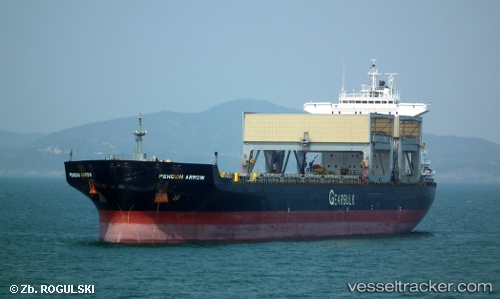
 Penguin Arrow
Current Status
Where is the vessel?
Penguin Arrow is currently in Near Docklands, based on AIS data received about 14h ago.
Latest AIS update:
Current position: 37.81705° S, 144.92204° E (Near Docklands)
Average speed (last 7 days): Loading…
Average speed (last 30 days): Loading…
Vessel profile: Penguin Arrow is a Multi Purpose Carrier with dimensions 200m x 32m.
This page combines live AIS, route history, probable destination signals, nearby traffic, and port activity for practical vessel monitoring.
The current position of vessel Penguin Arrow is -37.81705 lat / 144.92204 lng. Updated: 2026-06-25 11:15:13 UTCNearest reference points:
- Near Spotswood
- Near Drysdale
- Near QUEENSCLIFF
Currently sailing under the flag of Bahamas ![]()
Penguin Arrow built in 1997 year
Deadweight:
55506 tDetails:
Live Vessel Penguin Arrow Analytics (details, animations, etc.)
Recent AIS points (UTC):
2026-06-25 07:30:11 UTC · -37.81705, 144.92204 · SOG 0 kn · COG 245°2026-06-25 08:28:16 UTC · -37.81667, 144.92166 · SOG 0 kn · COG -1°
2026-06-25 09:24:12 UTC · -37.81705, 144.92204 · SOG 0 kn · COG 245°
2026-06-25 11:15:13 UTC · -37.81705, 144.92204 · SOG 0 kn · COG 245°