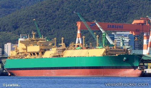
Lng Abuja Ii
Current StatusWhere is the vessel?
Lng Abuja Ii is currently in 282 nm SW of Al Azaiba, based on AIS data received about 14h ago.
Latest AIS update:
Current position: 25.84264° S, 53.98772° E (282 nm SW of Al Azaiba)
Average speed (last 7 days): Loading…
Average speed (last 30 days): Loading…
Vessel profile: Lng Abuja Ii is a Lng Tanker with dimensions 48m x 292m.
This page combines live AIS, route history, probable destination signals, nearby traffic, and port activity for practical vessel monitoring.
The current position of vessel Lng Abuja Ii is -25.84264 lat / 53.98772 lng. Updated: 2026-06-30 18:10:07 UTCNearest reference points:
- 271 nm E of Fort Dauphin
- 129 nm W of Al Azaiba
Details:
Live Vessel Lng Abuja Ii Analytics (details, animations, etc.)
Recent AIS points (UTC):
2026-06-30 14:19:16 UTC · -25.65423, 54.59511 · SOG 8.8 kn · COG 254°2026-06-30 16:06:27 UTC · -25.73943, 54.31211 · SOG 9.1 kn · COG 248°
2026-06-30 16:24:46 UTC · -25.75561, 54.26407 · SOG 9.1 kn · COG 248°
2026-06-30 18:10:07 UTC · -25.84264, 53.98772 · SOG 9 kn · COG 248°