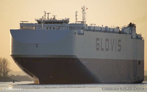
 Glovis Star
Current Status
Where is the vessel?
Glovis Star is currently in Near PYEONGTAEK, based on AIS data received about 16h ago.
Latest AIS update:
Current position: 36.97664° N, 126.82850° E (Near PYEONGTAEK)
Average speed (last 7 days): Loading…
Average speed (last 30 days): Loading…
Vessel profile: Glovis Star is a Vehicles Carrier with dimensions 200m x 36m.
This page combines live AIS, route history, probable destination signals, nearby traffic, and port activity for practical vessel monitoring.
The current position of vessel Glovis Star is 36.97664 lat / 126.82850 lng. Updated: 2026-05-22 20:03:03 UTCNearest reference points:
- Near PYEONGTAEK
- Near Dangjin
- Near Incheon
Currently sailing under the flag of Bahamas ![]()
Details:
Live Vessel Glovis Star Analytics (details, animations, etc.)
Recent AIS points (UTC):
2026-05-22 16:45:02 UTC · 36.97665, 126.82851 · SOG 0 kn · COG 330°2026-05-22 18:00:01 UTC · 36.97665, 126.82851 · SOG 0 kn · COG 330°
2026-05-22 19:54:06 UTC · 36.97666, 126.82851 · SOG 0 kn · COG 330°
2026-05-22 20:03:03 UTC · 36.97664, 126.82850 · SOG 0 kn · COG 330°