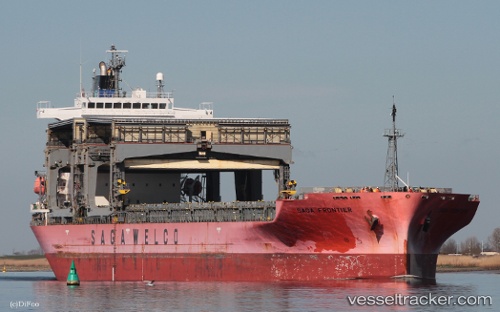
 SAGA FRONTIER
Current Status
Where is the vessel?
SAGA FRONTIER is currently in Near Naka-Ku, Kanagawa, based on AIS data received about 15h ago.
Latest AIS update:
Current position: 35.41650° N, 139.70670° E (Near Naka-Ku, Kanagawa)
Average speed (last 7 days): Loading…
Average speed (last 30 days): Loading…
Vessel profile: SAGA FRONTIER is a General Cargo with dimensions m x m.
This page combines live AIS, route history, probable destination signals, nearby traffic, and port activity for practical vessel monitoring.
The current position of vessel SAGA FRONTIER is 35.41650 lat / 139.70670 lng. Updated: 2026-05-30 19:31:03 UTCNearest reference points:
- Near Yokohama
- Near Kawasaki
- Near Naka-Ku, Kanagawa
Currently sailing under the flag of Bahamas ![]()
Details:
Live Vessel SAGA FRONTIER Analytics (details, animations, etc.)
Recent AIS points (UTC):
2026-05-30 16:46:01 UTC · 35.41638, 139.70827 · SOG 0 kn · COG 219°2026-05-30 18:00:59 UTC · 35.41651, 139.70776 · SOG 0 kn · COG 209°
2026-05-30 19:28:00 UTC · 35.41651, 139.70674 · SOG 0 kn · COG 169°
2026-05-30 19:31:03 UTC · 35.41650, 139.70670 · SOG 0 kn · COG 168°