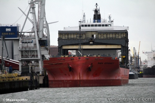
 SAGA ODYSSEY
Current Status
Where is the vessel?
SAGA ODYSSEY is currently in 73 nm S of TEBIG, based on AIS data received about 14h ago.
Latest AIS update:
Current position: 24.25405° S, 44.02320° W (73 nm S of TEBIG)
Average speed (last 7 days): Loading…
Average speed (last 30 days): Loading…
Vessel profile: SAGA ODYSSEY is a General Cargo with dimensions m x m.
This page combines live AIS, route history, probable destination signals, nearby traffic, and port activity for practical vessel monitoring.
The current position of vessel SAGA ODYSSEY is -24.25405 lat / -44.02320 lng. Updated: 2026-05-21 07:23:01 UTCNearest reference points:
- 61 nm S of TEBIG
- 49 nm S of SEPETIBA
- 27 nm SW of Santos Dumont Apt/Rio de Janeiro
Currently sailing under the flag of Bahamas ![]()
Details:
Live Vessel SAGA ODYSSEY Analytics (details, animations, etc.)
Recent AIS points (UTC):
2026-05-21 04:22:40 UTC · -24.67588, -44.32944 · SOG 10.1 kn · COG 34°2026-05-21 05:06:02 UTC · -24.56408, -44.27786 · SOG 10.1 kn · COG 24°
2026-05-21 05:55:30 UTC · -24.43984, -44.20849 · SOG 10.3 kn · COG 35°
2026-05-21 07:23:01 UTC · -24.25405, -44.02320 · SOG 10.4 kn · COG 36°