 vesseltracker.com
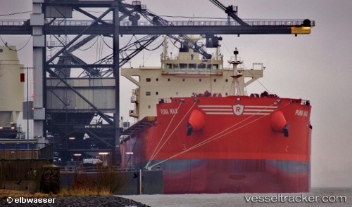
 Puma Max
Current Status
Where is the vessel?
Puma Max is currently in Near Erdemir, based on AIS data received about 1h ago.
Latest AIS update:
Current position: 41.26018° N, 31.37090° E (Near Erdemir)
Average speed (last 7 days): Loading…
Average speed (last 30 days): Loading…
Vessel profile: Puma Max is a Bulk Carrier with dimensions 229m x 32m.
This page combines live AIS, route history, probable destination signals, nearby traffic, and port activity for practical vessel monitoring.
The current position of vessel Puma Max is 41.26018 lat / 31.37090 lng. Updated: 2026-05-14 21:37:32 UTCNearest reference points:
- Near Erdemir
- Near Derince
- Near AUTOPORT
Currently sailing under the flag of Bahamas ![]()
Puma Max built in 2012 year
Deadweight:
81339 tDetails:
Live Vessel Puma Max Analytics (details, animations, etc.)
Recent AIS points (UTC):
2026-05-14 16:34:17 UTC · 41.29230, 30.36361 · SOG 10.6 kn · COG 92°2026-05-14 16:34:17 UTC · 41.29230, 30.36361 · SOG 10.6 kn · COG 92°
2026-05-14 21:37:32 UTC · 41.26018, 31.37090 · SOG 0.2 kn · COG 174°
2026-05-14 21:37:32 UTC · 41.26018, 31.37090 · SOG 0.2 kn · COG 174°