 LADY AILLAR
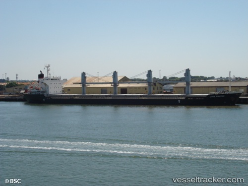
Current Status
Where is the vessel?
LADY AILLAR is currently in Near Luanda, based on AIS data received about 14h ago.
Latest AIS update:
Current position: 8.74714° S, 13.23962° E (Near Luanda)
Average speed (last 7 days): Loading…
Average speed (last 30 days): Loading…
Vessel profile: LADY AILLAR is a Bulk Carrier with dimensions m x m.
This page combines live AIS, route history, probable destination signals, nearby traffic, and port activity for practical vessel monitoring.
The current position of vessel LADY AILLAR is -8.74714 lat / 13.23962 lng. Updated: 2026-05-20 09:40:16 UTCNearest reference points:
- Near Luanda
- Near Greater Plutonio
Currently sailing under the flag of Barbados ![]()
Details:
Live Vessel LADY AILLAR Analytics (details, animations, etc.)
Recent AIS points (UTC):
2026-05-20 06:01:20 UTC · -8.74443, 13.23831 · SOG 0.3 kn · COG 169°2026-05-20 07:43:17 UTC · -8.74462, 13.23855 · SOG 0.1 kn · COG 172°
2026-05-20 08:04:19 UTC · -8.74561, 13.24005 · SOG 0.2 kn · COG 248°
2026-05-20 09:40:16 UTC · -8.74714, 13.23962 · SOG 0.1 kn · COG 314°