 ANKA BRAVE
Current Status
Where is the vessel?
ANKA BRAVE is currently in Near Trieste, based on AIS data received about 14h ago.
Latest AIS update:
Current position: 45.67720° N, 13.73246° E (Near Trieste)
Average speed (last 7 days): Loading…
Average speed (last 30 days): Loading…
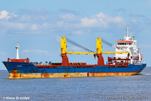
Vessel profile: ANKA BRAVE is a General Cargo with dimensions m x m.
This page combines live AIS, route history, probable destination signals, nearby traffic, and port activity for practical vessel monitoring.
The current position of vessel ANKA BRAVE is 45.67720 lat / 13.73246 lng. Updated: 2026-07-26 13:46:35 UTCNearest reference points:
- Near Trieste
- Near Ankaran
- Near IZOLA
Currently sailing under the flag of Barbados ![]()
Details:
Live Vessel ANKA BRAVE Analytics (details, animations, etc.)
Recent AIS points (UTC):
2026-07-26 10:13:33 UTC · 45.67784, 13.73001 · SOG 0 kn · COG 156°2026-07-26 11:43:35 UTC · 45.67779, 13.73138 · SOG 0 kn · COG 209°
2026-07-26 13:40:31 UTC · 45.67729, 13.73246 · SOG 0 kn · COG 244°
2026-07-26 13:46:35 UTC · 45.67720, 13.73246 · SOG 0 kn · COG 247°