 vesseltracker.com
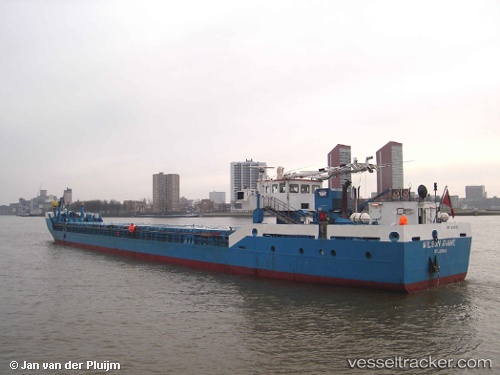
 Wilson Rhine
Current Status
Where is the vessel?
Wilson Rhine is currently in 12 nm NW of Molengat, based on AIS data received less than 1h ago.
Latest AIS update:
Current position: 53.14663° N, 4.37094° E (12 nm NW of Molengat)
Average speed (last 7 days): Loading…
Average speed (last 30 days): Loading…
Vessel profile: Wilson Rhine is a Multi Purpose Carrier with dimensions 78m x 10m.
This page combines live AIS, route history, probable destination signals, nearby traffic, and port activity for practical vessel monitoring.
The current position of vessel Wilson Rhine is 53.14663 lat / 4.37094 lng. Updated: 2026-04-26 07:56:48 UTCNearest reference points:
- Near Molengat
- Near Den Helder
- Near de Waal
Currently sailing under the flag of Barbados ![]()
Wilson Rhine built in 1998 year
Deadweight:
1815 tDetails:
Live Vessel Wilson Rhine Analytics (details, animations, etc.)
Recent AIS points (UTC):
2026-04-26 01:11:46 UTC · 54.14605, 5.01284 · SOG 9.2 kn · COG 197°2026-04-26 06:13:26 UTC · 53.40820, 4.53994 · SOG 9.7 kn · COG 198°
2026-04-26 07:30:13 UTC · 53.20756, 4.43008 · SOG 9.9 kn · COG 196°
2026-04-26 07:56:48 UTC · 53.14663, 4.37094 · SOG 9.9 kn · COG 229°