 vesseltracker.com
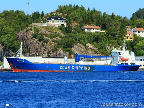
 Scan Fjord
Current Status
Where is the vessel?
Scan Fjord is currently in Near Gdansk, based on AIS data received about 9d ago.
Latest AIS update:
Current position: 54.36419° N, 18.65114° E (Near Gdansk)
Average speed (last 7 days): Loading…
Average speed (last 30 days): Loading…
Vessel profile: Scan Fjord is a Multi Purpose Carrier with dimensions 95m x 14m.
This page combines live AIS, route history, probable destination signals, nearby traffic, and port activity for practical vessel monitoring.
The current position of vessel Scan Fjord is 54.36419 lat / 18.65114 lng. Updated: 2026-03-29 13:40:24 UTCNearest reference points:
- Near Nowy Port/Gdansk
- Near Górki Zachodnie
- Near Sopot
Currently sailing under the flag of Barbados ![]()
Scan Fjord built in 1981 year
Deadweight:
3319 tDetails:
Live Vessel Scan Fjord Analytics (details, animations, etc.)
Recent AIS points (UTC):
2026-03-29 13:22:30 UTC · 54.36423, 18.65110 · SOG 0 kn · COG -1°2026-03-29 13:40:24 UTC · 54.36419, 18.65114 · SOG 0 kn · COG -1°
2026-03-29 13:40:24 UTC · 54.36419, 18.65114 · SOG 0 kn · COG -1°