 vesseltracker.com
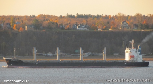
 LUNARA
Current Status
Where is the vessel?
LUNARA is currently in Near NEMRUT, based on AIS data received less than 1h ago.
Latest AIS update:
Current position: 38.76036° N, 26.92193° E (Near NEMRUT)
Average speed (last 7 days): Loading…
Average speed (last 30 days): Loading…
Vessel profile: LUNARA is a General Cargo Ship with dimensions 28m x 180m.
This page combines live AIS, route history, probable destination signals, nearby traffic, and port activity for practical vessel monitoring.
The current position of vessel LUNARA is 38.76036 lat / 26.92193 lng. Updated: 2026-05-16 13:33:55 UTCNearest reference points:
- Near NEMRUT
- Near Nemrut Bay
- Near Aliaga
Currently sailing under the flag of Barbados ![]()
LUNARA built in 2010 year
Deadweight:
33709 tDetails:
Live Vessel LUNARA Analytics (details, animations, etc.)
Recent AIS points (UTC):
2026-05-16 09:21:57 UTC · 38.76034, 26.92192 · SOG 0.1 kn · COG 140°2026-05-16 11:03:56 UTC · 38.76039, 26.92188 · SOG 0 kn · COG 140°
2026-05-16 11:51:56 UTC · 38.76039, 26.92187 · SOG 0.1 kn · COG 140°
2026-05-16 13:33:55 UTC · 38.76036, 26.92193 · SOG 0 kn · COG 140°