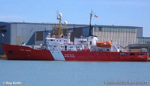
 Cape Roger
Current Status
Where is the vessel?
Cape Roger is currently in Near St. John’S, based on AIS data received about 14h ago.
Latest AIS update:
Current position: 47.55667° N, 52.70667° W (Near St. John’S)
Average speed (last 7 days): Loading…
Average speed (last 30 days): Loading…
Vessel profile: Cape Roger is a Fishing Support Vessel with dimensions m x m.
This page combines live AIS, route history, probable destination signals, nearby traffic, and port activity for practical vessel monitoring.
The current position of vessel Cape Roger is 47.55667 lat / -52.70667 lng. Updated: 2026-05-20 13:17:55 UTCNearest reference points:
- Near St. John’S
- Near Witless Bay
- Near Catalina
Currently sailing under the flag of Canada ![]()
Cape Roger built in 1977 year
Deadweight:
528 tDetails:
Live Vessel Cape Roger Analytics (details, animations, etc.)
Recent AIS points (UTC):
2026-05-20 09:59:33 UTC · 47.55667, -52.70667 · SOG 0 kn · COG -1°2026-05-20 10:41:22 UTC · 47.55712, -52.70746 · SOG 0 kn · COG 221°
2026-05-20 12:29:22 UTC · 47.55714, -52.70743 · SOG 0 kn · COG 221°
2026-05-20 13:17:55 UTC · 47.55667, -52.70667 · SOG 0 kn · COG -1°