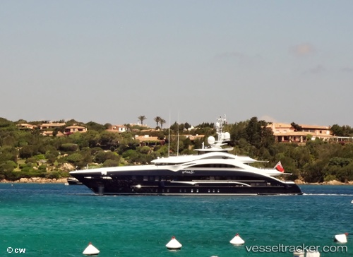
 JULIA
JULIA
Current Status
Where is the vessel?
JULIA is currently in 44 nm E of Port Raysut, based on AIS data received about 14h ago.
Latest AIS update:
Current position: 16.74333° N, 54.76333° E (44 nm E of Port Raysut)
Average speed (last 7 days): Loading…
Average speed (last 30 days): Loading…
Vessel profile: JULIA is a Pleasure Craft with dimensions m x m.
This page combines live AIS, route history, probable destination signals, nearby traffic, and port activity for practical vessel monitoring.
The current position of vessel JULIA is 16.74333 lat / 54.76333 lng. Updated: 2026-06-21 07:41:44 UTCNearest reference points:
- 103 nm S of Port Raysut
- 91 nm S of Pizhou
- 106 nm S of Port Raysut
Currently sailing under the flag of Cayman Islands ![]()
Details:
Live Vessel JULIA Analytics (details, animations, etc.)
Recent AIS points (UTC):
2026-06-21 06:23:33 UTC · 16.83000, 54.94833 · SOG 9 kn · COG -1°2026-06-21 06:23:33 UTC · 16.83000, 54.94833 · SOG 9 kn · COG -1°
2026-06-21 07:20:43 UTC · 16.77667, 54.80500 · SOG 8 kn · COG -1°
2026-06-21 07:41:44 UTC · 16.74333, 54.76333 · SOG 9 kn · COG -1°