 vesseltracker.com
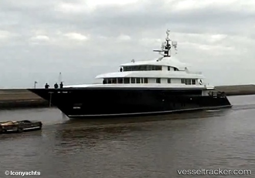
Icon
Current StatusWhere is the vessel?
Icon is currently in Near NORMAN ISLAND, based on AIS data received about 1h ago.
Latest AIS update:
Current position: 18.35911° N, 64.58965° W (Near NORMAN ISLAND)
Average speed (last 7 days): Loading…
Average speed (last 30 days): Loading…
Vessel profile: Icon is a Service Ship with dimensions 12m x 68m.
This page combines live AIS, route history, probable destination signals, nearby traffic, and port activity for practical vessel monitoring.
The current position of vessel Icon is 18.35911 lat / -64.58965 lng. Updated: 2026-04-15 10:14:31 UTCNearest reference points:
- Near Norman Island
- Near Spanish Town
- Near Charlotte Amalie
Details:
Live Vessel Icon Analytics (details, animations, etc.)
Recent AIS points (UTC):
2026-04-15 04:20:30 UTC · 18.35849, -64.58930 · SOG 0 kn · COG 13°2026-04-15 06:02:31 UTC · 18.35844, -64.58915 · SOG 0 kn · COG 350°
2026-04-15 07:41:30 UTC · 18.35842, -64.58951 · SOG 0 kn · COG 38°
2026-04-15 10:14:31 UTC · 18.35911, -64.58965 · SOG 0 kn · COG 160°