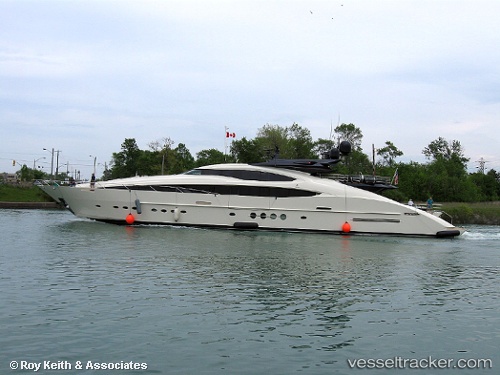
 LADY M
Current Status
Where is the vessel?
LADY M is currently in Near IMPERIA, based on AIS data received about 14h ago.
Latest AIS update:
Current position: 43.87765° N, 8.02414° E (Near IMPERIA)
Average speed (last 7 days): Loading…
Average speed (last 30 days): Loading…
Vessel profile: LADY M is a Yacht with dimensions 65m x 10m.
This page combines live AIS, route history, probable destination signals, nearby traffic, and port activity for practical vessel monitoring.
The current position of vessel LADY M is 43.87765 lat / 8.02414 lng. Updated: 2026-06-07 20:31:06 UTCNearest reference points:
- Near IMPERIA
- Near Diano Marina
- Near Riva Ligure
Currently sailing under the flag of Cayman Islands ![]()
LADY M built in 2013 year
Deadweight:
0 tDetails:
Live Vessel LADY M Analytics (details, animations, etc.)
Recent AIS points (UTC):
2026-06-07 16:28:03 UTC · 43.87770, 8.02411 · SOG 0 kn · COG 138°2026-06-07 18:40:01 UTC · 43.87772, 8.02409 · SOG 0 kn · COG 138°
2026-06-07 19:01:08 UTC · 43.87774, 8.02406 · SOG 0 kn · COG 138°
2026-06-07 20:31:06 UTC · 43.87765, 8.02414 · SOG 0 kn · COG 138°