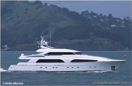
 DRIVEN
Current Status
Where is the vessel?
DRIVEN is currently in Near Greenport, based on AIS data received about 14h ago.
Latest AIS update:
Current position: 41.10042° N, 72.35945° W (Near Greenport)
Average speed (last 7 days): Loading…
Average speed (last 30 days): Loading…
Vessel profile: DRIVEN is a Yacht with dimensions m x m.
This page combines live AIS, route history, probable destination signals, nearby traffic, and port activity for practical vessel monitoring.
The current position of vessel DRIVEN is 41.10042 lat / -72.35945 lng. Updated: 2026-06-27 01:30:25 UTCNearest reference points:
- Near PLUM ISLAND
- Near Springville, Suffolk
- Near Southport
Currently sailing under the flag of Cayman Islands ![]()
Details:
Live Vessel DRIVEN Analytics (details, animations, etc.)
Recent AIS points (UTC):
2026-06-26 22:03:24 UTC · 41.10040, -72.35946 · SOG 0 kn · COG 166°2026-06-26 22:06:23 UTC · 41.10039, -72.35945 · SOG 0 kn · COG 165°
2026-06-27 00:27:32 UTC · 41.10041, -72.35944 · SOG 0 kn · COG 165°
2026-06-27 01:30:25 UTC · 41.10042, -72.35945 · SOG 0 kn · COG 165°