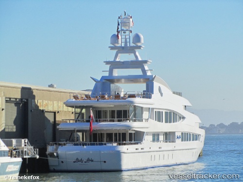
 Lucky Lady
Current Status
Where is the vessel?
Lucky Lady is currently in Near Cefalù, based on AIS data received about 14h ago.
Latest AIS update:
Current position: 38.04099° N, 14.01281° E (Near Cefalù)
Average speed (last 7 days): Loading…
Average speed (last 30 days): Loading…
Vessel profile: Lucky Lady is a Service Ship with dimensions 63m x 62m.
This page combines live AIS, route history, probable destination signals, nearby traffic, and port activity for practical vessel monitoring.
The current position of vessel Lucky Lady is 38.04099 lat / 14.01281 lng. Updated: 2026-07-19 01:19:31 UTCNearest reference points:
- Near Palermo
- Near Licata
- Near Balestrate
Currently sailing under the flag of Cayman Is ![]()
Lucky Lady built in 2002 year
Details:
Live Vessel Lucky Lady Analytics (details, animations, etc.)
Recent AIS points (UTC):
2026-07-18 21:49:27 UTC · 38.04085, 14.01210 · SOG 0.1 kn · COG 142°2026-07-18 22:28:31 UTC · 38.04090, 14.01275 · SOG 0 kn · COG 234°
2026-07-19 00:10:27 UTC · 38.04076, 14.01282 · SOG 0 kn · COG 272°
2026-07-19 01:19:31 UTC · 38.04099, 14.01281 · SOG 0.1 kn · COG 252°